Edwards – Carlsbad Springs
The rural neighbourhood of Edwards-Carlsbad Springs includes the communities of Carlsbad Springs, Edwards, Piperville and Ramsayville. The boundaries are described as Ramsayville Road (W), Milton Road & Frank Kenny Road (E), Ridge Road (N), and Mitch Owens Road (S).
Edwards is a dispersed rural community at the headwaters of Bear Brook and is named after William Cameron Edwards, a lumberman, MP (Russell 1887-1903), and Senator. Until the tracks were torn up in 1957, Edwards was a flag stop for the New York and Ottawa Railway. Today, the community has golf courses, a City park, an Orange Lodge, and a solar farm (at Parkway & Yorks Corners.
Carlsbad Springs was named in 1906 after the famous health spa in the Czech Republic, now called Karlovy Vary. However, in the 1860s, the site was known as Cathartic because of the healing qualities of the mineral springs at Russell Road and Bear Brook. Guests came “to take the waters” for ailments such as rheumatism, nervousness, and digestive disorders. (Carlsbad Springs Community Association has an excellent history online here.) European tourists resulted in the German, Swiss, and Austrian minorities who still live in the area. Today, residents enjoy activities at social clubs and the Community Centre.
Amazon is opening a distribution and fulfillment centre on Boundary Road at Hwy 417 that could be transformative for rural Eastern communities: a 1,000,000 sq.ft. warehouse with 99 truck loading Bayshore and 1,008 parking spaces that will offer as many as 800 jobs.
NOTE: ONS is committed to periodically reviewing neighbourhood boundaries, in consultation with community associations, residents and other stakeholders. The boundaries for this neighbourhood have changed significantly and care should be taken when comparing data over time. Carlsbad Springs was previously described as part of the Navan-Carlsbad Springs neighbourhood
View Map
View Photos
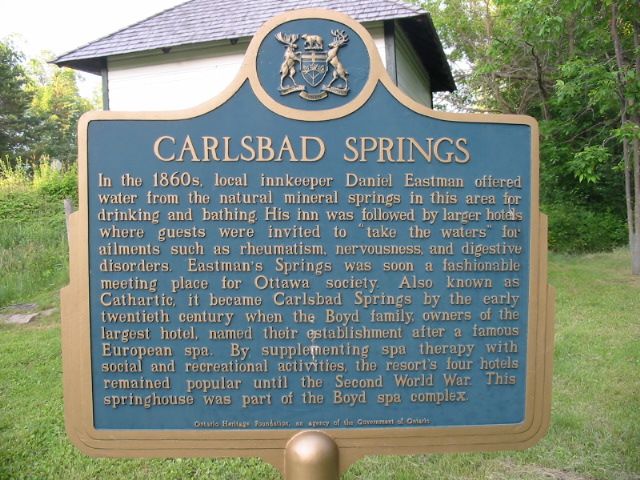
Carlsbad Springs – Historical Plaque
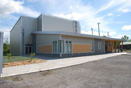
Carlsbad Springs Community Centre